Bathymetric Surveys
High-accuracy bathymetric surveys for rivers, lakes, reservoirs, quarries and coastal sites. USV & sonar mapping with fast turnaround.
About
Bathymetric Surveys from Igne
High-accuracy bathymetric surveys for rivers, reservoirs, lakes, canals, quarries and coastal environments, delivered safely, quickly and with complete confidence.
Igne provides professional bathymetric surveys across the UK using advanced USV (uncrewed surface vehicle) and sonar technology to map underwater terrain with exceptional precision.
Whether you’re planning infrastructure works, monitoring assets, managing water bodies or assessing risks, we deliver the detailed data you need to design safely and make informed decisions.
This is a commercial, end-to-end service, not just data capture. Our team handles scoping, access, safety, acquisition, processing, modelling and delivery, giving you a seamless and reliable solution every time.
Useage
Who We Work With
Bathymetric surveys are incredibly valuable across numerous sectors, providing critical data to a range of stakeholders:
Infrastructure & Construction Projects
Developers and engineers use bathymetric surveys to assess waterbed conditions before constructing bridges, piers, or other infrastructure. This ensures that project are built on stable ground, minimising the risk of subsidence or structural failure.
Environmental Monitoring & Conservation
Evironmental scientists and conservationists rely on bathymetric data to monitor changes in underwater ecosystems. These surveys help detect shifts in waterbed conditions, erosion, sedimentation, and other factors that affect aquatic environments.
Flood Risk Management
Government agencies and flood risk managers utilise bathymetric surveys to model water flow and volume in rivers and reservoirs. By understanding underwater terrain, authorities can better predict flood behaviour and develop more effective flood prevention strategies.
Navigation & Safety
Bathymetric surveys are also vital for ensuring the safety of vessels navigating inland waterways. By identifying underwater obstructions or shallow areas, these surveys help minimise the risk of collisions or grounding.
Organisations that regularly commission bathymetric surveys include:
- Civil and structural engineers
- Flood risk and hydrology teams
- Local authorities and environmental bodies
- Water companies and utilities
- Quarry operators and mineral estates
- Infrastructure contractors
- Port, harbour and marine asset owners
- Renewable energy and hydropower developers
- Insurance, monitoring and compliance consultants
Basically, if you manage, design, maintain or regulate a water environment, Igne’s bathymetric surveys are designed for you.
Trust
What We Deliver
We know you want clarity, accuracy and dependable outputs. Every Igne bathymetric survey provides:
- High-resolution depth data
- Digital terrain models (DTM)
- Contours, heatmaps and cross-sections
- Point clouds
- Volume calculations (dredging, siltation, stockpiles)
- Integrated datasets with topographic or UAV surveys
- Full reporting with metadata, methodology and QA
- Deliverables can be supplied in formats including DWG, DXF, ASCII, CSV, LAS, GeoTIFF and engineering-ready PDFs.
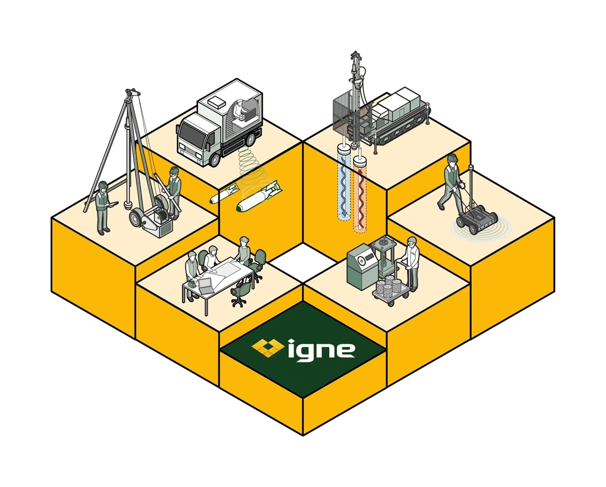
Capabilities
Bathymetric Survey Capabilities
Survey Environments:
Inland water bodies (rivers, lakes, reservoirs, canals)
Flood channels and attenuation ponds
Quarries, lagoons and silt ponds
Harbours, marinas and coastal margins
Restricted-access and hazardous environments
Depth & Accuracy:
Depth capability: typically up to 30–40m depending on water clarity and substrate
Positional accuracy: cm-level with GNSS/RTK
Vertical accuracy: typically ±5–10cm (system dependent)
Technology:
USV single-beam and multi-beam sonar systems
Remote operation for increased safety
Integrated GNSS, IMU and real-time positioning
Optional GPR, UAV, topo and GI data integration
Safety & Access:
Our USVs avoid the need for manned boats, providing:
Safer operation
Lower mobilisation costs
Survey access in shallow, contaminated, hazardous or restricted areas
Minimal disruption to operations or public spaces
Benefits
The Benefits of Bathymetric Surveys
Bathymetric surveys offer a wide range of benefits that extend beyond basic data collection, enhancing the safety, sustainability, and success of projects.
Accurate, Real-Time Data
Bathymetric surveys provide highly detailed maps of underwater terrain, allowing for real-time data collection and analysis. This enables faster decision-making, especially in time-sensitive projects like flood risk management or emergency infrastructure repairs.
Non-Invasive Methodology
Using sonar technology and unmanned surface vehicles (USVs), bathymetric surveys are non-invasive and environmentally friendly. These surveys can be conducted without disturbing the aquatic environment or impacting local wildlife, making them ideal for sensitive ecosystems.
Cost-Effective
By identifying potential issues early in the project lifecycle, bathymetric surveys help prevent costly mistakes or delays. Accurate data on underwater conditions allows for better planning and risk management, reducing the likelihood of unexpected setbacks.
Comprehensive Coverage
Bathymetric surveys can cover large areas quickly, making them ideal for projects that span multiple locations or involve vast water bodies. This ensures that even the most remote or hard-to-reach areas are thoroughly examined.
Improved Safety
For projects involving vessels or personnel working on or near water, bathymetric surveys enhance safety by identifying potential hazards, such as submerged objects or unstable ground.
Process
How We Deliver Your Bathymetric Survey
Here is the clear workflow:
1. Project Scoping
We review site details, constraints, previous data and technical requirements to define the right methodology for accuracy and coverage.
2. Access & Safety Planning
RAMS, permits, water safety planning, exclusion zones and environmental considerations are completed prior to mobilisation.
3. Mobilisation of USV & Survey Kit
Our team deploys compact, highly manoeuvrable USVs, ideal for tight, shallow or high-risk environments.
4. Sonar Data Acquisition
High-resolution sonar is used to capture bed profiles, obstructions, deposits, scour and waterbody morphology.
5. Data Processing & Modelling
Our GIS and CAD teams clean, validate and model the data to produce clear, engineering-ready deliverables.
6. Reporting & Delivery
You receive a complete package: depth data, models, charts, interpretation and any required integrations with UAV or topographic datasets.
This structured approach removes ambiguity, reduces risk and ensures predictable, repeatable results.
Learn More
Frequently Asked Questions about Bathymetric Surveys
- What technology is used in bathymetric surveys?
Bathymetric surveys typically use sonar technology, which sends sound waves to the waterbed and measures the time it takes for them to return. This data is used to map the depth and contours of the underwater terrain.
- Can bathymetric surveys be done in small water bodies?
Yes, bathymetric surveys can be conducted in a wide range of water bodies, from small rivers and ponds to large lakes and reservoirs. USVs are particularly useful for smaller, hard-to-access areas.
- How often should bathymetric surveys be conducted?
The frequency of bathymetric surveys depends on the specific needs of the project. For environmental monitoring or flood risk management, regular surveys are recommended to track changes in underwater terrain over time.
- What are USV inland water surveys?
USV inland water surveys use unmanned surface vehicles to map rivers, lakes, and other inland water bodies. These surveys are critical for infrastructure development, flood management, and environmental monitoring in inland areas.
- What are river cross and long section surveys?
River cross and long section surveys map the profile of a riverbed, measuring depth along the width and length of the river. These surveys are vital for understanding water flow, erosion patterns, and flood risks.
Learn More about Specific Bathymetric Surveys
The Next Step
Discover how Igne’s bathymetric surveys can provide critical insights for your next project.
Most firms can collect sonar data. Few can integrate it into a complete, multidisciplinary understanding of the ground.
We offer:
- National coverage with rapid mobilisation
- Highly experienced survey and geospatial teams
- Integrated capability across GI, UAV, topo, GPR and monitoring
- Safer, boat-free workflows through USV platforms
- Precise, consistent deliverables trusted by engineers and asset owners
- A proven track record across infrastructure, water, civils and environmental sectors
- If you want a bathymetric survey done safely, accurately and with a fast turnaround, Igne is the right partner.
For quotes, technical advice, scoping support or to send site information, speak to our surveying team.
Topographical Surveys
Igne’s topographical surveys deliver precise site data for planning, design, and construction using the latest GPS, total station, and UAV technology.
Utility Surveys
Utility surveys locate and map underground utilities such as gas lines, water pipes, electrical cables, and sewers. This is critical for avoiding costly damage during excavation and construction.
GPR (Ground Penetrating Radar) Surveys
GPR surveys use radar pulses to image the subsurface, identifying buried objects, voids, and changes in material properties. GPR is particularly useful for detecting utilities, rebar, and other subsurface features.
Measured Building Surveys
These provide accurate measurements of existing buildings, including floor plans, elevations, and cross-sections. They are essential for refurbishment, renovation, or extension projects.
Monitoring Surveys
Monitoring surveys track changes in a site over time, such as ground movement, settlement, or structural deformation. These surveys are vital for ensuring the ongoing safety and stability of a site.
Mapping Surveys
By integrating surveying, UAV, utility mapping and geophysical expertise, Igne delivers mapping surveys that give you a complete, coordinated understanding of your site - reducing risk, saving time and supporting better decisions.
Drone (UAV) Surveys
Drone surveys offer aerial mapping and photography, providing a bird’s-eye view of the site. They are ideal for large or difficult-to-access areas, delivering high-resolution data quickly and efficiently.
Bathymetric Surveys
Bathymetric surveys measure the depth and topography of underwater sites, such as rivers, lakes, and coastal areas. These surveys are essential for projects involving water bodies or marine environments.
CAD & Data Processing
After data collection, our CAD and data processing services transform raw survey data into detailed maps, models, and reports. This information is presented in a format that is easy to understand and use for further planning and design.