![]()
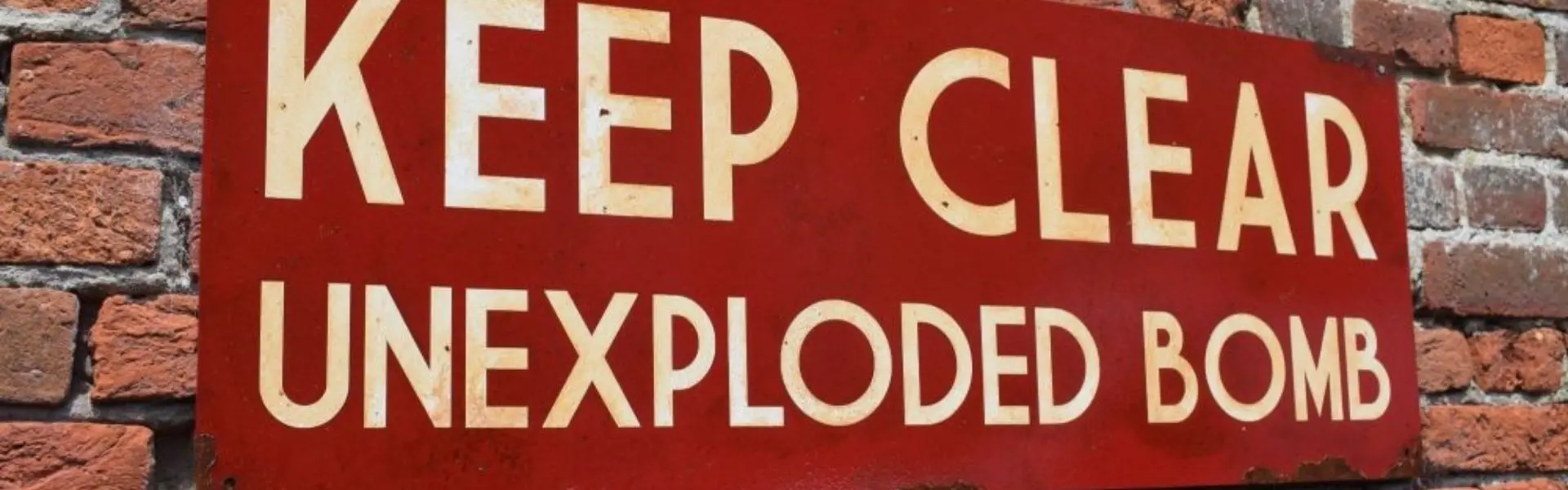
Bomb Risk Identified on Public Walking Land
Ramblers have been warned about UXO on public paths now reopened after the fires on Langdale Moor. Igne EOD experts are on standby...
Back in August, a major incident was declared when a fire broke out on Langdale Moor. The moor is near to RAF Fylingdales and was used as a tank training ground during WWII.
The fire caused residual unexploded ordnance to explode, with more than 18 explosions recorded during the fire.
This is one of the more extreme reminders that WWII training areas still present a huge risk across large parts of the UK’s countryside and public rights of way.
Along with public encounters, Igne’s experience at a number of former training areas has highlighted a lack of sufficient disposal methods during wartime following the closure of the training grounds and the removal of the military presence. Not only were items abandoned in place, but large quantities were buried beneath the ground, dumped into ponds, lakes and craters, and remained undeclared.
So what does that mean for us now?
Former military training areas remain one of the most likely places that UXO could be encountered across the UK.
Here’s an example: Igne carried out a full survey and clearance operation at a former training area in eastern England.
This image shows just a sample of British UXO found within one part of the former training site:

It's not just training areas either, former barracks, camps, airfields, defensive positions, batteries and other former military requisitioned ground are also vulnerable to UXO contamination today.
This is backed by Igne’s research too.
Of a dataset containing over 1,000 publicly shared UXO discoveries, over half found were Allied in origin (mostly British and American). The next largest category is “unspecified”, which just means the source hasn’t confirmed whether the item was Allied or German.
Putting those “Allied” UXO finds onto a map of known military-occupied sites mostly correlates, but also confirms that UXO can be encountered in even unexpected locations. Take a look at these snippets showing Allied UXO found in and around former training areas within the UK:


Speaking of data, Igne’s Free Online UXO Risk Map contains thousands of data points for former British and Allied military activity across the UK. This can help to inform of areas that may be vulnerable to UXO contamination from military training, occupation, weapons manufacture and storage, disposal and testing, and defences.
We are updating this data regularly, and our next phase is due for release soon. Also, our explosive ordnance disposal experts are always available to offer expert UXO comment to the media, or for site specific training to support the safe development of construction and infrastructure sites across the UK.
Other articles of interest
Igne signs Armed Forces Covenant
This is a proud week for us at Igne as our Director of UXO, Lucie Tiverrier, has signed the Armed Forces Covenant.

Igne launch
Igne launch sees transformative merger of six leading companies to reshape pre-construction services in the infrastructure, energy and water sectors.