![]()
GI for Flood Risk Appraisal
Igne delivered a comprehensive ground investigation for the Millom and Haverigg Flood Risk Appraisal Scheme, including deep boreholes, in-situ testing, groundwater monitoring, and full laboratory analysis. The dataset provides the robust geotechnical and hydrogeological evidence needed to design effective flood defences for the community.
Igne was appointed to undertake a comprehensive ground investigation in support of the proposed Millom and Haverigg Flood Risk Appraisal Scheme.
The scheme is expected to include a combination of new flood defence walls, embankments, and groundwater cut-offs designed to protect residential and industrial areas in and around Millom.
The purpose of the site investigation was to establish baseline ground and groundwater conditions and to collect geotechnical and geo-environmental data to inform design.
The investigation focused primarily on sites within Millom, with an additional borehole drilled in the nearby village of Haverigg to the southwest.
Ground Investigation Scope
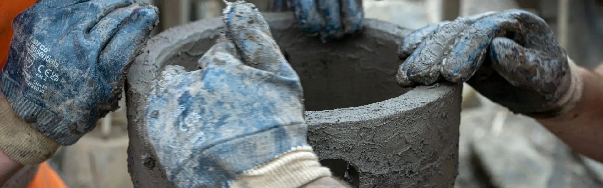
- Twelve cable percussive boreholes to depths between 9.70 and 16.00 m below ground level.
- In-situ testing, including standard penetration tests (SPT), hand shear vane, photo-ionisation detector, water quality parameter, permeability (slug and rising/falling head) tests.
- Groundwater monitoring using mini-diver data-loggers.
- Installation of groundwater instrumentation in all boreholes.
- Monthly post-site monitoring of groundwater levels.
- Geotechnical and geo-environmental laboratory testing.
- Compilation and production of a factual report.
Site operations were carried out across 2 months, with post-site monitoring and laboratory testing continuing over subsequent months.
All twelve boreholes were completed with groundwater monitoring instrumentation, enabling the continuous collection of data during and after site works. Results were subsequently correlated and presented in a detailed factual report, providing a robust dataset to support the design of the proposed flood defences.
Igne’s ground investigation provided the client with high-quality, site-specific data to inform safe and sustainable design decisions for the flood protection scheme. The findings underpin an improved understanding of the local hydrogeological regime - a critical factor in the effective design of embankments and groundwater control structures.
Flood resilience starts with knowing what lies beneath. Igne’s expert ground investigation, testing, and monitoring services give design teams the confidence to plan, mitigate, and build with precision - even in the most sensitive or high-risk environments.
If your flood risk, infrastructure, or environmental project needs dependable ground and groundwater intelligence, talk to Igne.
Other articles of interest

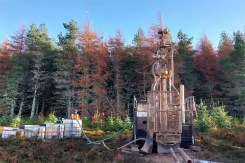
Strathy South Wind Farm
Igne recently undertook an extensive site investigation project on behalf of SSE Renewables for the Strathy South Wind Farm. This contract spanned 15 weeks and took place in an incredibly environmentally sensitive area of Scotland.
Ground investigation for a proposed substation Loch Buidhe
Igne was commissioned by SSEN Transmission to undertake the ground investigation at this proposed substation site at Loch Buidhe. The investigations were needed to provide information on the ground conditions for foundation design and construction of the proposed works and in relation to any geochemical contamination of the site.